![]()
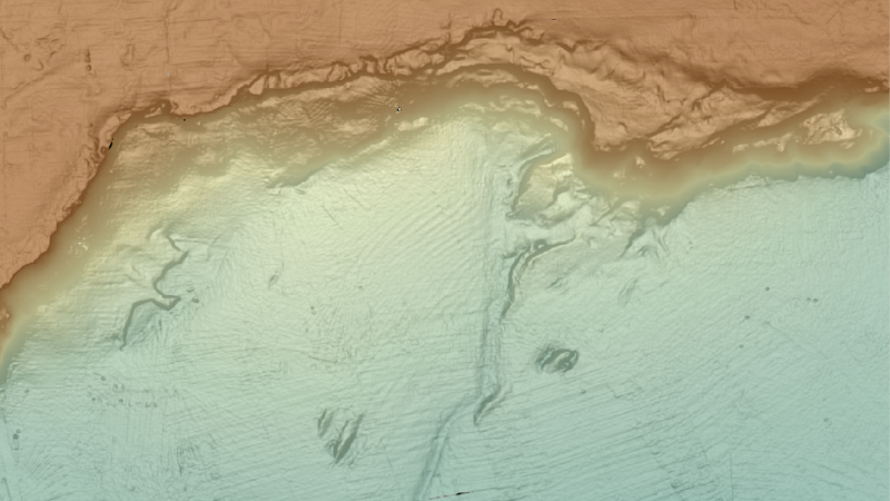
The General Bathymetric Chart of the Ocean (GEBCO) aims to produce free, open and complete seabed data and information for the world’s oceans. It operates under the joint auspices of the International Hydrographic Organization (IHO) and the IOC. Find out more about GEBCO’s vision and mission from its Strategy.
Bathymetric charts have been in existence since the 16th century, but only during the early 1900s were charts starting to become standardised. Since then, 5 editions of the GEBCO chart series have been published. In the 1990s GEBCO moved to digital products, with a global set of bathymetric contours made available for the first time in 1994 on CD-ROM as part of the GEBCO Digital Atlas.
GEBCO now makes its bathymetric products available online in the form of grids. The data sets can be downloaded as global files or for user-defined areas in a number of formats. GEBCO’s bathymetric grids are also made available as Web Map Services and printable maps.
GEBCO also maintains and makes available a digital Gazetteer of Undersea Feature Names.
Information about the full range of GEBCO’s products and services can be found from its web site.
The Nippon Foundation-GEBCO Seabed 2030 Project
![]()
Seabed 2030 is a collaborative project between GEBCO and The Nippon Foundation with the aim to facilitate the complete mapping of the global ocean floor by the year 2030.
The operational launch of the project was announced by Mr Yohei Sasakawa, Chairman of The Nippon Foundation, at a press conference in February 2018.
UK Contributions
The UK is heavily involved in bathymetric mapping and the work of GEBCO and The Nippon Foundation-GEBCO Seabed 2030 Project through individuals and organisations such the National Oceanography Centre (NOC) the British Oceanographic Data Centre (BODC) as part of NOC; the UK Hydrographic Office (UKHO), the British Antarctic Survey (BAS) and the British Geological Society (BGS).
Staff involved in GEBCO/Seabed 2030 and general mapping activities:
- Dr Helen Snaith (BODC at NOC) is Head of The Nippon Foundation-GEBCO Seabed 2030 Global Center
- Jamie McMichael-Phillips (Former UKHO representative in Singapore) is the Director of The Seabed 2030 Project
- Pauline Weatherall (BODC at NOC) is the GEBCO Digital Atlas Manager
- Jennifer Cheveaux (BODC at NOC) Seabed 2030 Administrator
Summary of contributions:
- Data has been provided by BAS, BODC and NOC.
- Data has been submitted to EMODnet Digital Bathymetry via the NOC, BODC and BGS.
- As part of its Seabed 2030 GDACC role, BODC acts as a Trusted Node for Crowdsourced Bathymetry (CSB) data sets. This involves the processing of submitted CSB data sets from mariners and the submission of the processed data to the IHO Data Centre for Digital Bathymetry who make the data generally available.
- Bathymetry data collected on NOC research cruises is processed and used by scientists in their work.
GEBCO has a number of groups, an overview of these and UK participation is found in the table below.
| GEBCO Groups and UK Point of Contact | |||
|---|---|---|---|
| Group | Remit | Point of Contact | Organisation |
| Joint IOC-IHO Guiding Committee for GEBCO | To oversee the work of the GEBCO sub-committees and working groups. | None | N/A |
| Technical Sub-Committee on Ocean Mapping | Designated authority for all technical matters relevant to the goals of GEBCO | Pauline Weatherall Helen Snaith | BODC at NOC |
| Sub-Committee on Regional Undersea Mapping | To build a closer collaboration with regional mapping efforts and coordinate, as well as encourage, the incorporation of their compilations into GEBCO | Pauline Weatherall | BODC at NOC |
| Sub-Committee on Undersea Feature Names | To maintain and make available the IHO-IOC GEBCO Gazetteer of Undersea Feature Names | None | N/A |
| Sub-Committee on Communications, Outreach and Public Engagement (SCOPE) | To coordinate the communications, outreach and external relations strategy and activities conducted to support and raise awareness of the GEBCO Project and to complement the focused outreach activities of the Seabed 2030 initiative | Pauline Weatherall | BODC at NOC |